
Photography by Harry Wagner
Spanning over 400 miles, the Sierra Nevada Range is the most famous mountain range on the west coast. It includes three national parks, twenty wilderness areas, and two national monuments. It is also home to the largest alpine lake in North America (Lake Tahoe) and the highest point in the contiguous United States (Mount Whitney at 14,505 feet). But this story isn’t about the Sierra Nevada. This story is about the Sweetwater Range in the Toiyabe National Forest.

The aspen trees on the west side of the range provide an explosion of color in the fall. We were too early for those colors on our trip but made plans to return when the temperature dropped. The risk is that if you wait too late in the year the road over the top of the range becomes impassible.
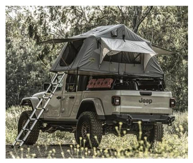
Located to the east of the Sierra Nevada near the sleepy town of Walker, the Sweetwater Range is not visited nearly as much as say, Yosemite. And that was exactly what drew us to the area when Ryan Kennelly was passing through last summer. Ryan is the design team lead at 4Wheel Parts during the week, but on the weekends, he likes to get out and explore. On this trip, Ryan had flown into Wyoming to buy this 1981 Toyota Pickup sight unseen and spend as many miles in the dirt as possible on his way back to Southern California. You don’t need a heavily modified vehicle to explore this area, but a supple suspension and the ability to air down your tires when you leave the pavement and air them back up with a compressor at the end of the trail are highly recommended.

Even if you don’t go all the way over Mount Patterson, the west side of the Sweetwater Range offers numerous excellent camp sites near Lobdell Lake. This would be a great place to stop and enjoy some seclusion for those travelling along 395.
We took Ryan up and over Mount Patterson, to an elevation of 11,654 feet. Besides Mount Patterson, other peaks in the Sweetwater Range include Wheeler Peak (elevation 11,664 feet) Middle Sister (elevation 10,859 feet) and East Sister (elevation 10,580 feet). The factory carb on the top of his 22R engine never skipped a beat along the way. The road to Mount Patterson starts along Highway 395 in the town of Walker. Once leaving pavement you start to climb steadily past Burcham Creek and Lobdell Lake. During our visit, the “lake” was more of a mud puddle due to drought conditions, but there is an old cabin near the lake that makes a good camp site. You could run this entire trail in a day, but there are several wonderful camp sites that are worth exploring over a weekend. Just remember to bring your overlanding gear like your rooftop tent, awning, and camp chairs.

The Mount Patterson area is part of a delicate ecosystem. Staying on existing trails is very important to the viability of the area. Travelling off existing paths can damage sensitive vegetation and create ruts that will last for decades.
Aspens give way to juniper and juniper give way to low ground cover past Lobdell Lake and the road continues to climb. The Sweetwater Mountains largely consists of a geologic pluton surrounded by volcanic flow from the Little Walker Caldera. Above the timberline, the Sweetwater Range provides habitat for many rare plants in the rhyolitic soil. Referred to as “Mars with flowers”, the area is unlike anyplace else we have ever visited. We got to the peak at dusk and I managed to take a wrong turn, despite assuring Ryan that I know exactly where I was going. We ended up spending the night near the stone cabin at the Montague Mine. It was a wonderful spot so Ryan was none the wiser.

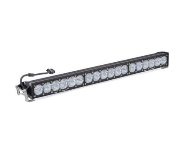
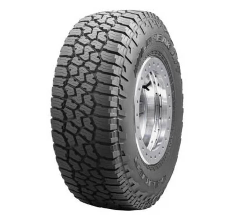
You don’t need a highly modified vehicle to explore the Sweetwater Range. This 2002 Toyota Tundra has a 30-inch Baja Designs LED light bar to light up the night and upgraded suspension to fit 33-inch tall Falken Wildpeak AT3W tires.
I was hoping to camp at Belfort, but things don’t always go according to plan. The ghost towns of Belfort and Clinton are on the eastern side of the range. Both of these small gold mining camps had post offices in the 1880s, and many of their structures are still standing. Between 1880 and 1884 the Patterson Mining District produced $500,000 in gold and silver, $13M in today’s value. By 1888 only one mine remained active. There are several other abandoned gold mining camps and gold mines in the range, including Boulder Flat, Angelo Mission Mine, Kentuck Mine, Frederick Mine, Longstreet Mine, Lilly Mine, Deep Creek Mine, and Tiger Mine.

From this vantage point you can see multiple mountain ranges in any direction. We visited the Sweetwater Range in August when it was warm in the valley below but quite cool at night at higher elevations. During the winter this area is impassible with snow drifts up to 20 feet tall.
We encountered a group of UTVs in Belfort, but otherwise had the area to ourselves. Below Belfort the juniper trees returned as we descended towards Highway 338. Ryan and I reinflated our tires to proper street pressure before parting ways, with me returning north to Reno and him continuing south. While he had never heard of the Sweetwater Range before our trip, it created memories neither of us will ever forget.

We didn’t time our trip very well, arriving at the summit at sunset. This led to a wrong turn, but that is part of the adventure. After setting up camp at lower elevation we were able to backtrack to the summit and find the correct path down the east side of the range.

The Ancient Bristlecone Pine Forest is south of the Sweetwater Range in the White Mountains, but there are bristlecones in the Sweetwaters as well. Bristlecone pines grow in isolated groves just below the tree line in dolomitic soils. Dolomitic soils are alkaline, high in calcium and magnesium, and low in phosphorus. Those factors tend to exclude other plant species, allowing bristlecones to thrive.

The old mining camp of Belfort is located on the east side of the Sweetwater Range. This is a great place to camp with pine trees, flat camp sites, and fire rings. The cabins can be explored, but please leave them for the next visitor just as you found them.

2